East Yorkshire coastal erosion
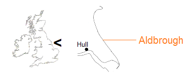
Aldbrough
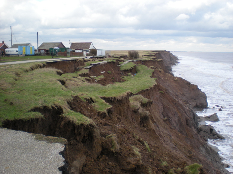
Just as elsewhere along the Holderness coast, the ice-age clays continually break and slide into the sea.
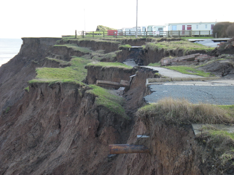
Eroded road.
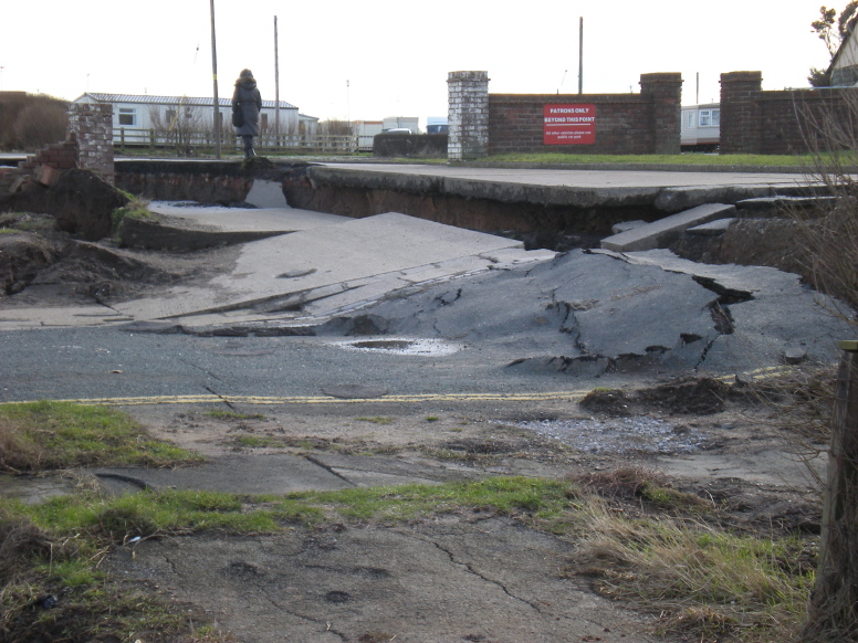
The process creeps towards the entrance to a caravan park...
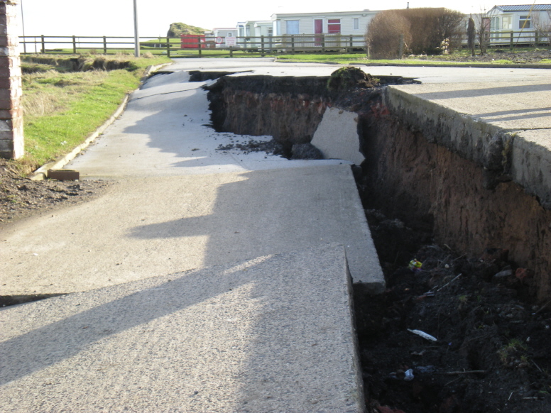
...towards the pitches.
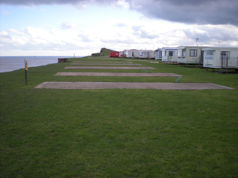
Caravans are moved away from the edge, leaving concrete bases...
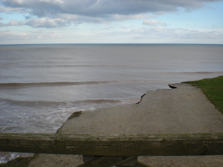
...which will eventually succumb.
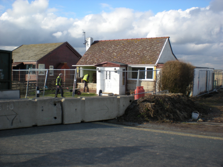
A chalet along the disappearing road is prepared for demolition.
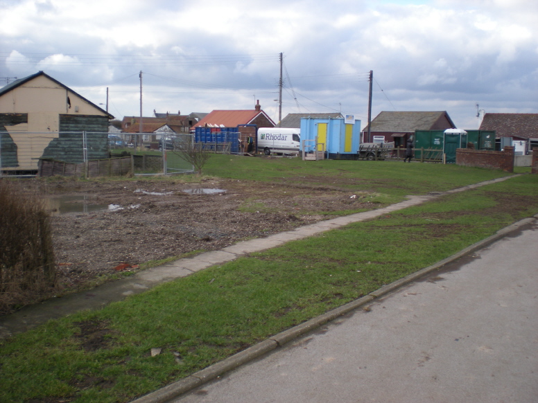
The Aldbrough cliffs community is being rolled back.
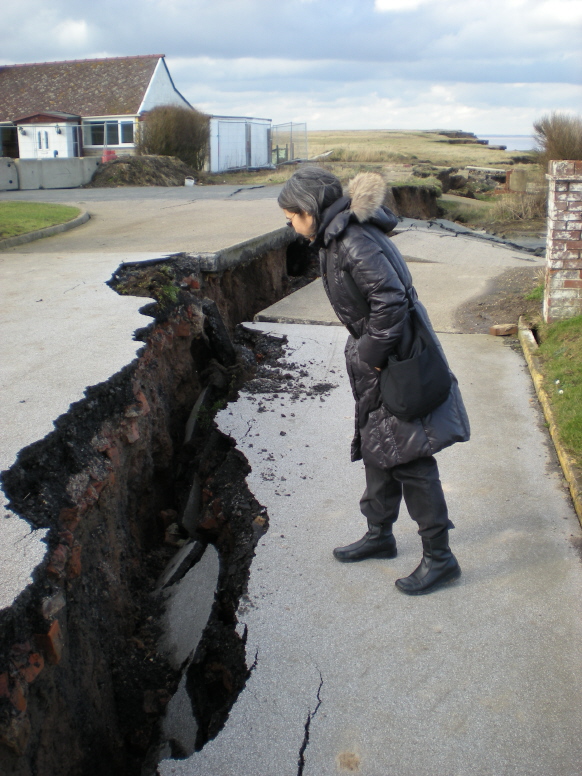
The above pictures were taken 14 February 2011.

The Ordnance Survey map 1852 to 1854 shows a road or track running parallel to the cliff line, 1.13 kilometres in straight length. On either side of the indicated Talbot Hotel (later Sea View) and neighbouring Spa Inn (later the Royal Hotel), a cliff top community would grow – see Richard Clarke.
A photograph taken around the late 1920s shows the cliff edge encroaching on farm buildings at Salf Hill, with possibly Sea View just visible in the distance – see Withernsea CCO, image 2.
Opposite the Talbot is Seaside Road, the route to the village of Aldbrough. This road too would in time attract a community, which survives today.
The brown line drawn on the map marks the approximate position of the cliff edge in 2011.
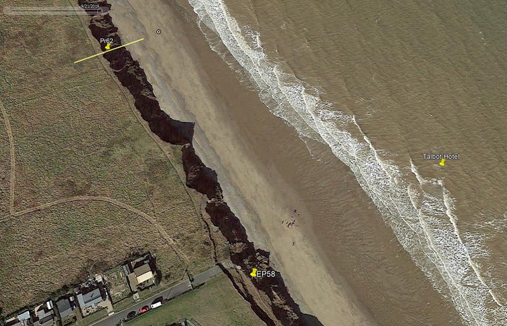
Included in the above Google Earth map dated 9/21/2019 (21 September 2019) are two cliff loss measurement points.
Pr62, or Monitoring Profile 62, belongs to the current ‘era’ of calculating cliff recession. The pin is placed on the cliff line as it was in 2017, and the circled dot further out represents the position in 2003.
EP58, or Erosion Post 58, relates to the previous method of measurement.
Also pinned is the site of the Talbot Hotel.
data in detail – background to data collection
cliff loss data – menu
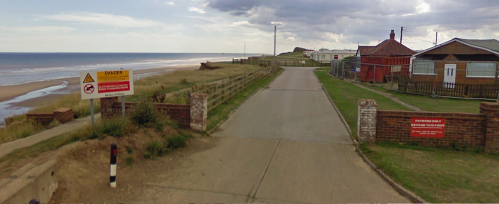
Now completely gone, the former eastern entrance to Aldbrough Caravan Park served as Erosion Post EP58 from 1951 to 2010, the date of this Google Street View. Total cliff recession over the period is recorded as 130.09 metres.
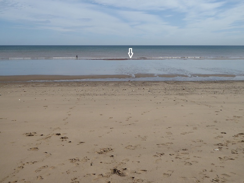
The arrow marks the beach coordinates for the Talbot Hotel (land surface would have been an estimated 24 metres or so above). Picture taken from the foot of the cliff, figure for scale [29 August 2019].
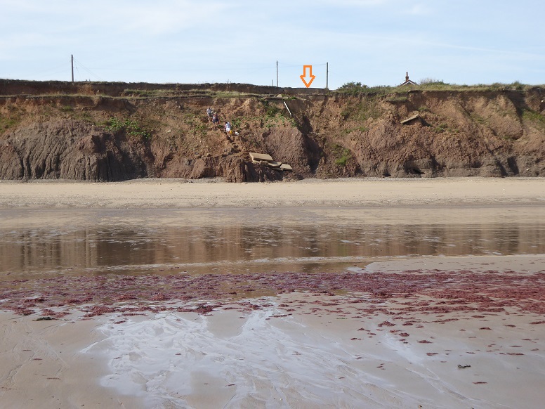
Seaside Road end, approximately 157 metres distant, seen from the beach coordinates of the Talbot Hotel, descending figures for scale [29 August 2019].
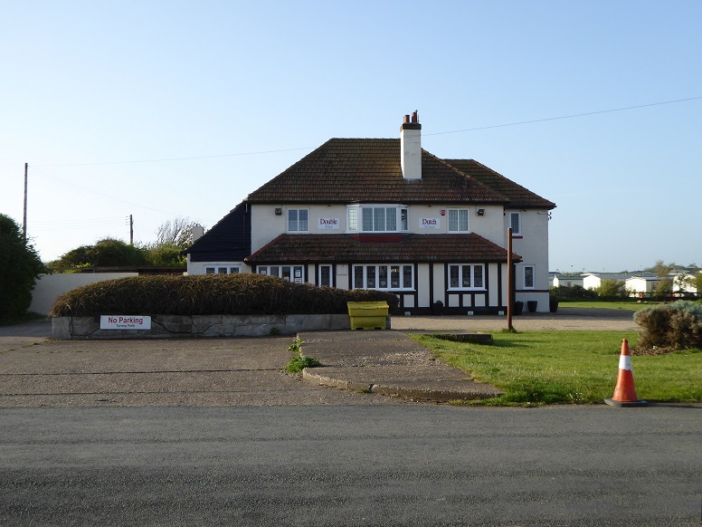
The Talbot Hotel was closed around 1915. A replacement for the Royal Hotel (formerly Spa Inn) was built on the south side of Seaside Road in the 1930s. Latterly called the Double Dutch, it has more recently been renamed The Sellwood Arms. At the time of taking, the left side of the picture lay some 72 metres from the cliff edge in the same direction [22 May 2022].
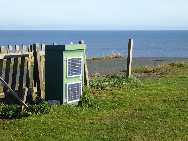
The British Geological Society maintains a coastal landslide observatory (CLO) at Seaside Road end. An unassuming cabinet monitors information from instruments inserted in boreholes drilled in the cliff top close by [18 October 2022].
The cabinet has since been removed though twice-a-year surveys and data collection continue.
Aldbrough Coastal Landslide Observatory
report (2001-2013)
study (2019)
top
Content by Brian Williams unless otherwise stated.