go straight to:
causes and processes
picture galleries (locations, themes)
data (cliff loss, sundries)
resources
causes and processes
- terminal groyne effect (TGE)
- beach movement
- migration chart – autumn 2008 to autumn 2024
- beach levels and cliff loss (inc. sea level rise)
galleries list below map
locations
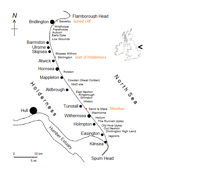
The towns of Bridlington (population 35,441 as per 2019 estimate), Hornsea (pop. 8,793) and Withernsea (pop. 6,381) border the coast and are protected by substantial sea defences. Villages, except for Mappleton, are located a little inland but most have a cliff top community associated with them. Hamlets and other sites are shown on the map.

- Barmston
- Ulrome
- Skipsea
- enlargements of above
- Green Lane, Skipsea
- Skipsea Withow
- Hornsea south (defences)
- Mappleton
- Mappleton (defences)
- Great Colden
- Aldbrough
- Ringbrough
- Tunstall / Sand le Mere
- Withernsea south (defences)
- Withernsea south rock extensions
- Hollym
- The Runnell, Holmpton
- Kilnsea (Godwin Battery)
- southern tip storm damage
themes
external links
top
data (cliff loss)
- data summary – 2003 to 2023 / 1854 to 2023
- data in detail – background to data collection
- cliff lines – includes maximum cliff loss 2003 to 2024
current monitoring system
- last ten years [spreadsheet] [pdf] – autumn 2015 to spring 2024
(seasons) - twenty-two years [spreadsheet] – autumn 2003 to spring 2025
(seasons) - twenty-two years [spreadsheet] – 2003 to 2024
(years)
previous monitoring system
- full data and locations [spreadsheet] – 1951 to October 2013
- in years [spreadsheet] – 1951 to 2013
- abstract [spreadsheet] – 1951 to 2010
combined previous and current systems
- [page] [spreadsheet] – 1951 to 2020 (70 years)
current system and back projection
- [spreadsheet] [csv] – 1852 to March 2025
historical surveys
- Pickwell survey [spreadsheet] – various dates to 1876
- Thompson survey [spreadsheet] [locations pdf] – 1852 to 1922
- Valentin survey [spreadsheet] – 1852 to 1952
- Matthews, Bell [spreadsheet] – various dates
data sundries
- activity index
- cliff heights [spreadsheet]
- beach width [spreadsheet]
- groyne fields [spreadsheet]
- erosion calculator online – 1854 to 2024
- erosion calculator download – 1854 to 2024
- output of beach and cliff loss relationship program
resources
- links and references
- England Coast Path (pdf)
- profile coordinates and cliff heights [spreadsheet]
- fieldwork version of above [spreadsheet] [pdf]
- land use
- aerial archive links
- archive maps index
- distance calculator
- the myth of total coastal protection
- radiocarbon to calendar date conversion
top
contact
home