East Yorkshire coastal erosion
pillboxes
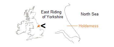
This page lists many of the military pillboxes and some other (mainly) wartime remnants found in situ and on the beach along the coast of the East Riding of Yorkshire, the greater part of which is called Holderness. Entries are presented from north to south.
Because of their ease of recognition and relative durability, such structures can be convenient for illustrating the extent of coastal erosion as well as changes to the beach.
Pillboxes in the list are often of the lozenge type, a design specific to the north-east of England. Other structures are described accordingly.
UK Grid Reference Finder helps in locating a listed item. Copy/paste the TA sequence – letters and numbers – into the Grid Reference box on the finder page, and press Go.
Most entries include a reference in square brackets as used in the Rapid Coastal Zone Assessment Survey.
Bridlington north
TA 21035 69182 [BR24] on golf course
TA 19807 68411 [BR65] eared pillbox, remains on beach
Wilsthorpe / Carnaby
TA 16668 64393 [CA5/CA7] in field
TA 16791 64159 [CA10] corner of field
TA 17064 63719 [CA24] eared pillbox, cliff face
TA 16770 63680 [CA27] in field
Fraisthorpe
TA 17034 63349 [CA33, ‘Earwig Villa’] eared pillbox, almost on beach, resting against anti-tank wall (see Chris Kolonko)
TA 17029 63292 [CA34] beach light, on beach
TA 16724 63172 [BA3] side of field
TA 16987 63607 to TA 16956 63320 row (290 metres in length) of six square pillboxes
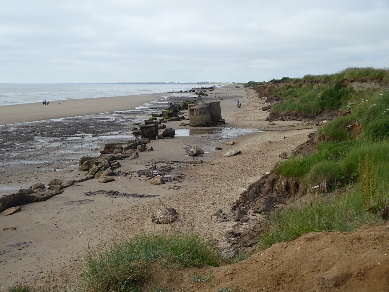
TA 17029 63292 [CA34]
During World War Two, the low-lying coastline from Bridlington to Barmston was extensively prepared for resisting enemy invasion. Anti-tank blocks were placed at the foot of dunes or the cliff to form a continuous line, with pillboxes and other structures positioned behind.
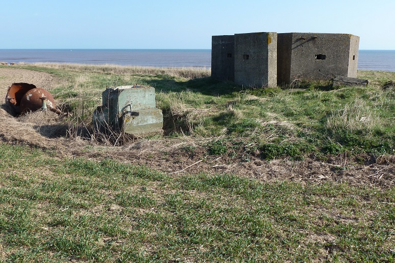
Surviving military material marks the course of the upper beach as it was in 1941. The line curves steadily away as cliff loss increases southward down the coast – see map‑chart.
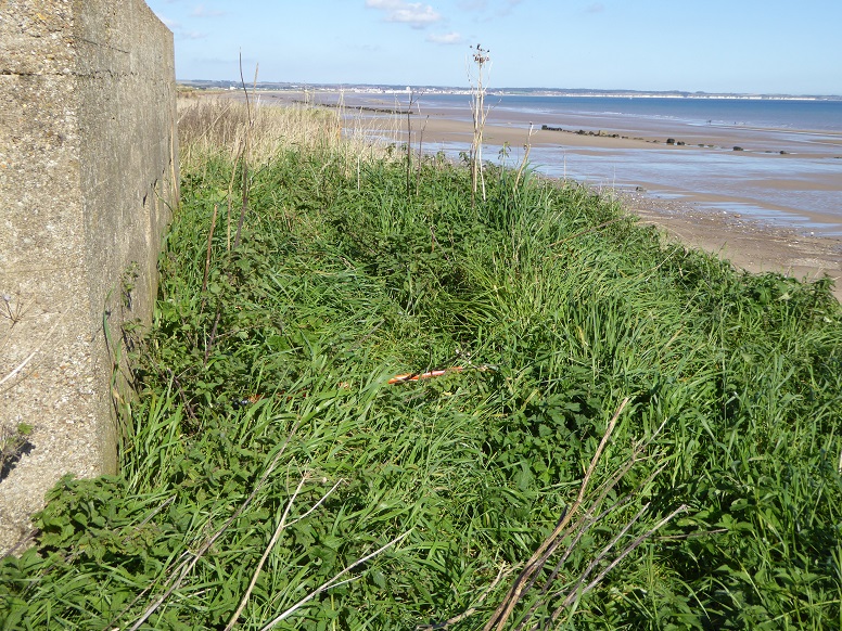
Viewed from pillbox CA33, the picture shows a concrete housing for a light by which to illuminate the beach in the event of a night-time attack. Cliff retreat is apparent [28 June 2018].
Auburn
TA 16868 62781 square pillbox [BA10] in enclosure on east side of Auburn Farm
TA 17027 62723 split base and collapsed remains of eared pillbox, on beach
(see Alex Francon)
TA 16855 62692 square pillbox [BA19] in field south-east of Auburn Farm
TA 16727 62639 square pillbox [BA22] in field south of Auburn Farm
TA 16898 62309 paired square pillboxes [BA30] opposite sides of dyke
TA 17012 62098 collapsed remains of an eared pillbox, on beach
TA 17013 62050 [BA34] beach searchlight, on beach
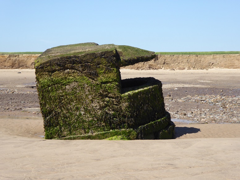
TA 17013 62050 [BA34]
Another beach light. This piece, originally at the cliff, lies almost 70 metres out [28 June 2018].
Earls Dyke
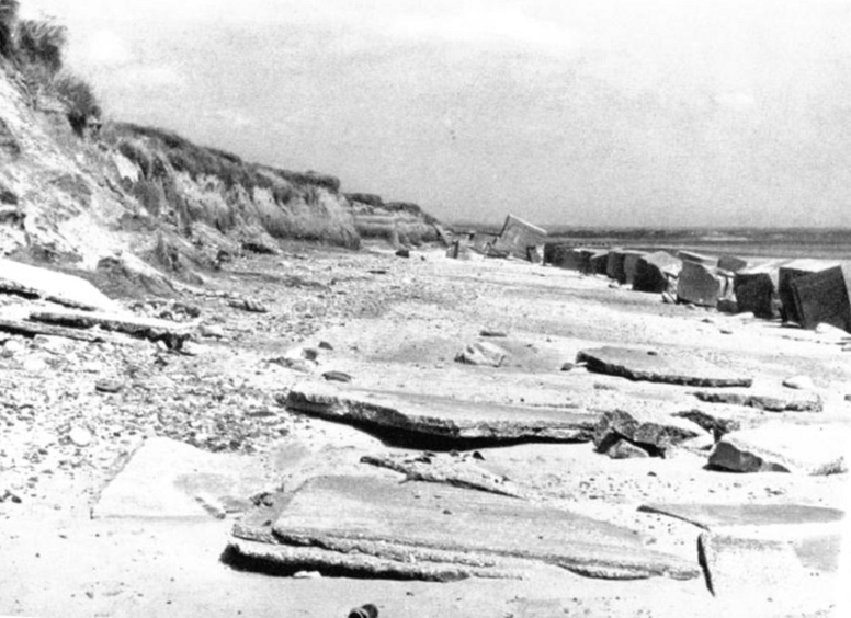
TA 170 620
The coast between Auburn and Earls Dyke once featured dunes, reported as long-established. As elsewhere, anti-tank blocks were laid down in 1941, at the line of the dunes.
Towards the end of the decade, wave action washed the dunes away. The gap left by removal is shown in this picture, taken during the Valentin survey, 1952.
TA 16984 61308 collapsed remains of eared pillbox, on beach
TA 16616 61275 [BA67] in field
TA 16880 61149 [BA74] square pillbox, near cliff edge
TA 16892 61148 [BA75] on beach, breaking
Barmston, north of
TA 16869 60687 square pillbox 22 metres inland of BA84
TA 16891 60685 [BA84] cliff top
TA 17021 60545 [BA89] collapsed remains of eared pillbox, on beach
TA 16426 60475 [BA90] in field
TA 16735 60229 [BA94] square pillbox, in field
TA 16443 59939 [BA104] side of field
TA 16737 59700 [BA111] in field on former field boundary
TA 16923 59613 [BA118] in field, plus square pillbox 46 metres to south
TA 16891 60685 [BA84]
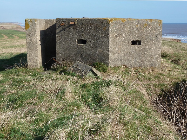
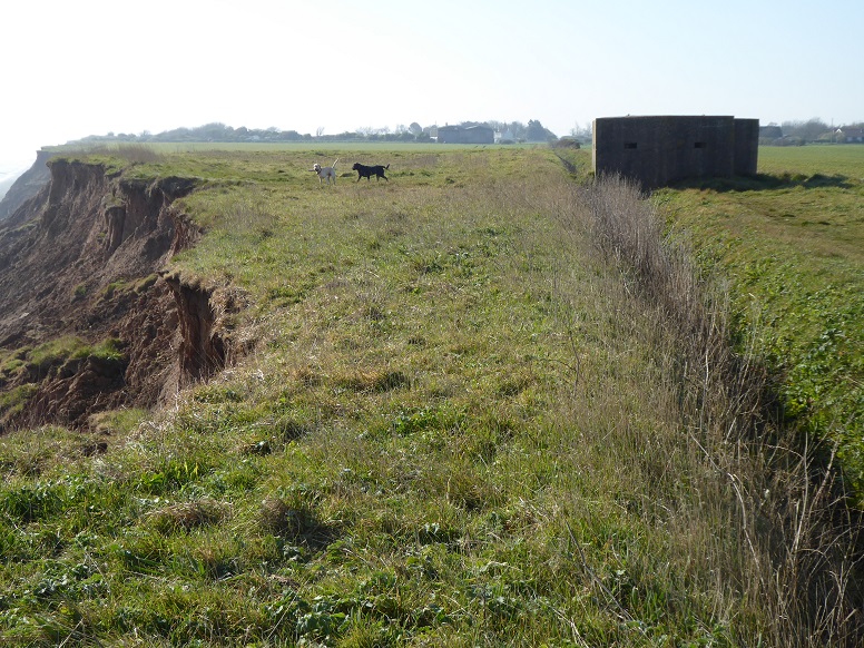
Pillbox BA84 sits near the edge of the cliff.
In the background, the line of anti-tank blocks indicates the scale of cliff recession since the pillbox was put up in the early 1940s [22 September 2017].
Blocks and the remains of other military structures sited in the approaches to Barmston were recycled around 1978, this time to serve as a defence against the waves – see Sands Lane.
Barmston, south of
TA 17048 58842 [BA152] in field
Barmston Outfall
TA 17100 58595 [UL2] by side of drain
Barmston Outfall, south of
TA 17073 58484 [UL3] in field
TA 17207 58220 [UL72] cliff top
TA 17121 58071 [UL11] in field
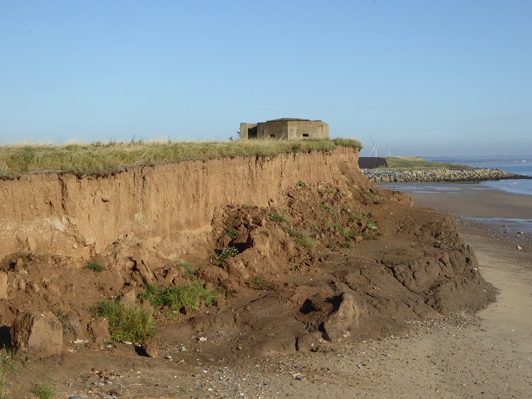
TA 17207 58220 [UL72] – 1
Seen here also at the cliff edge, this pillbox formerly served as a measuring point during the erosion post era of monitoring cliff recession.
Between 1952 and 2010 (59 years), a loss was recorded of 104.84 metres, an average of 1.78 metres per year.
The cliff has undergone differential erosion of till units, and a clay shelf is evident [22 September 2017].
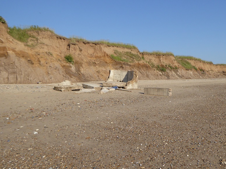
TA 17207 58220 [UL72] – 2
When the cliff failed (see top left), the pillbox toppled to rest inverted and broken on the beach [23 June 2022].
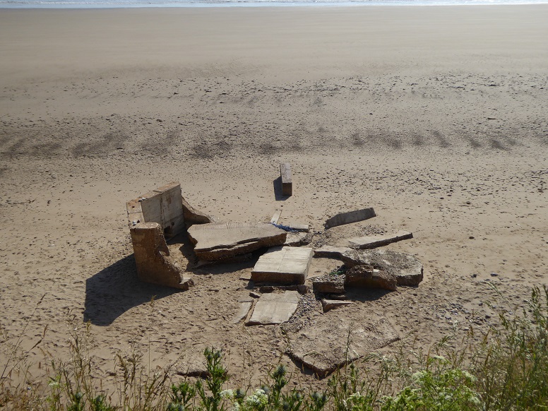
TA 17207 58220 [UL72] – 3
From the cliff top [23 June 2022].
Ulrome
TA 17394 57505 [UL38] edge of cliff in caravan park
TA 17414 56776 [UL58] in field
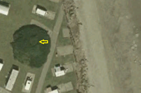
TA 17394 57505 [UL38] – 1
An arrow marks the location, lost under a mass of vegetation and about 15 metres from the cliff, of the pillbox at Seaside Caravan Park [Google Earth historical: 2003].
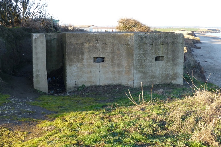
TA 17394 57505 [UL38] – 2
Pillbox with enveloping growth gone, at the cliff edge [4 December 2013].
The structure was later demolished and the debris removed.
Skipsea
TA 17407 56350 [UL65] caravan park
Skipsea, south of
TA 17725 55769 [SK3] in field
TA 17902 55467 [SK8] in field
Skipsea, Cliff Road
TA 17969 55174 [SK13] between road and field
Skipsea Withow
TA 18059 54730 [SK50] square pillbox at side of dyke
TA 18072 54632 [SK18] in field
TA 18395 54466 [SK63] square pillbox in field
TA 17937 54409 [SK33] in field
TA 17873 53950 [SK40] in field
TA18538 54084 [SK60] fragment on beach
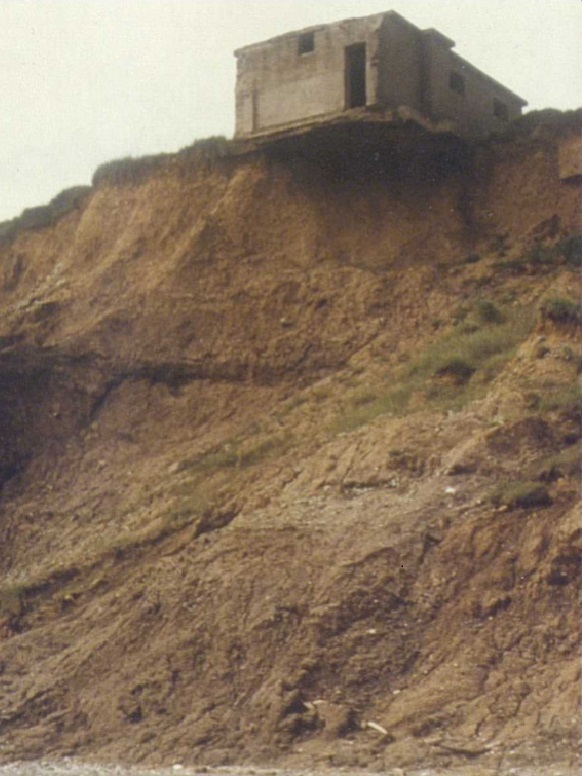
(TA 1870 5367)
Picture taken during fieldwork to complete a doctoral thesis submitted in 1985. Although the original purpose of the structure is unclear, the area at the cliff top was the location of a wartime training camp and decoy airfield [Susan Jane Mason, c. 1983].
Skirlington
TA 18730 52740 [AT3] in caravan park
TA 18940 52204 [AT11] in field
Atwick, north of
TA 19286 51981 concrete base, on beach
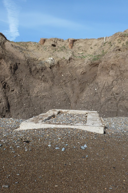
TA 19286 51981
Not a wartime remnant but once part of a North Sea gas storage facility constructed at the cliff top 1973 to 1975 and extended in 1983. Distance from the cliff foot measures 2.44 metres [26 May 2013].

TA 19286 51981
The base is breaking up but a former brine disposal shaft is now exposed [Timothy‘s Travels: 7 February 2025].
Atwick, Long Lane
TA 19459 51248 [AT23] at side of track
Atwick (behind Long Lane)
TA 18997 51781 [AT18] in field
TA 19384 51155 [AT24] rectangular, in field
Atwick, south of
TA 19654 50756 [AT49] caravan park
TA 19767 50409 [AT58] in field
TA 19785 50395 [AT59] in field
Hornsea
TA 20108 48553 [HO28] housing estate
TA 19866 48259 [HO38] behind bowling club
TA 19691 48134 [HO41] gardening allotments
TA 20875 47095 [HO117] behind caravan park, Hornsea Burton
TA 19632 46432 south of Hornsea Mere
Mappleton
TA 22553 44212 [MA24] in village
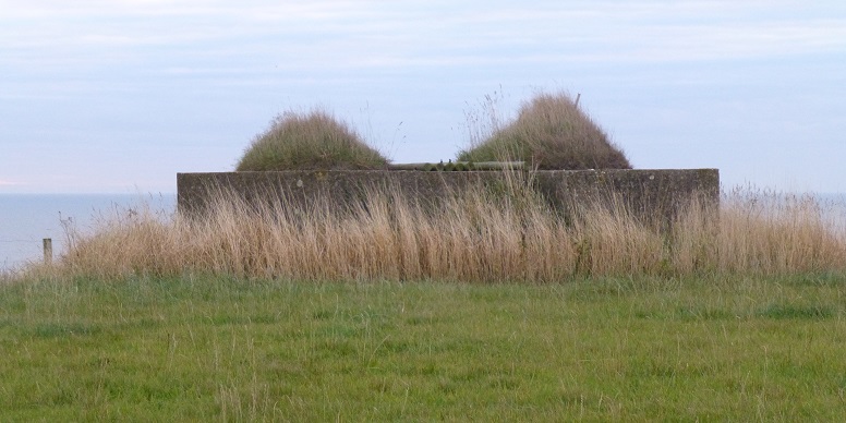
TA 22553 44212 [MA24]
Although the pillbox at Mappleton is close to the cliff edge, coastal defences protect it into the foreseeable future [5 October 2013].
Cowden, MoD site
Former army tank firing then RAF bombing range
TA 23845 42184 (main piece) fragments of structure(s) on beach
TA 23871 42100 [MA73] fragments of structure(s) on beach
TA 24073 41580 observation shelter within site
TA 24147 41721 [MA74] observation shelter on beach
TA 24204 41588 observation shelter on beach
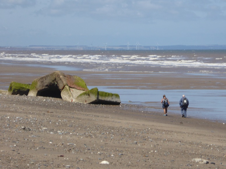
TA 24147 41721 [MA74]
Beach walkers approach the remains of a military observation shelter south of Cowden. The position within the MoD site was TA 24131 41706 [12 July 2017].
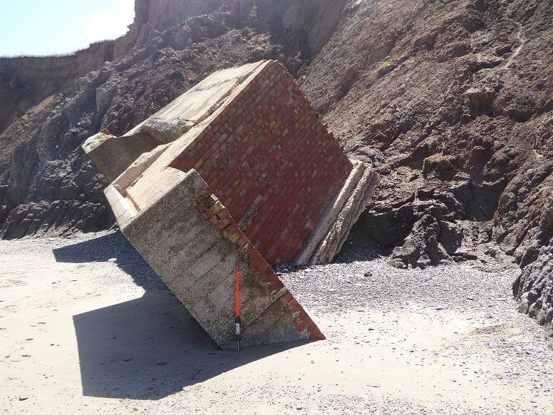
TA 24204 41588 – 1
Newly descended observation shelter, located at TA 24193 41578 when on land. Scaling rod is approximately one metre overall length [12 July 2017].
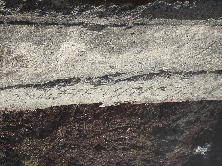
TA 24204 41588 – 2
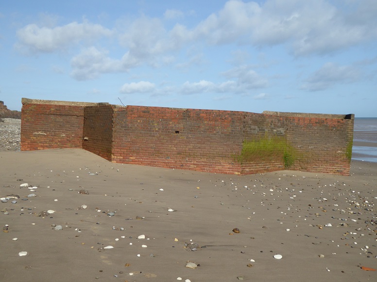
Markings made during construction can often be found on military items. The inscription on the upper surface of this piece reads: 23 1 43 F. EVINGTON.
(TA 24204 41588) – 3
Since descent, the shelter has been reorientated and shifted by tides as if to present a wall across the upper beach [29 September 2023].
Aldbrough
TA 25499 39599 [AL10] farmyard
East Newton
TA 25940 38913 [AL30] in field
TA 26341 38627 [AL60] on beach
TA 26427 38565 [AL39] on beach
TA 26557 38600 [AL63] on beach
TA 26636 38061 [AL44] former car park
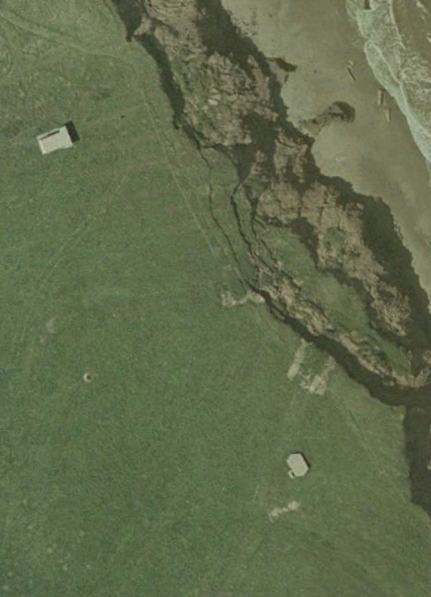
Two of the East Newton units were erected close to each other. In the satellite imagery, both structures are seen 27 metres back from the cliff edge [Google Earth historical: 2003].
TA 26341 38627 [AL60] – 1
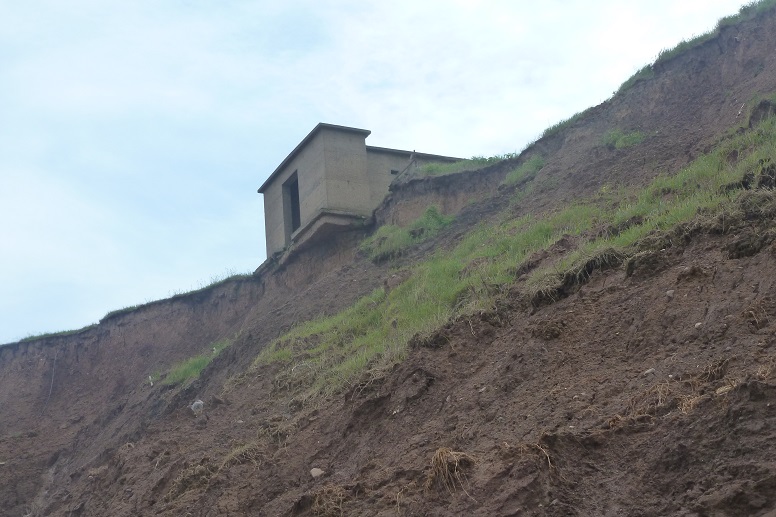
The larger unit served as a generator room for the Chain Home Low (CHL) radar network. Later, it was used as an animal shelter.
Overlooking the edge [10 June 2012].
(TA 26341 38627) [AL60] – 2
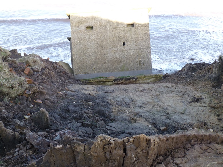
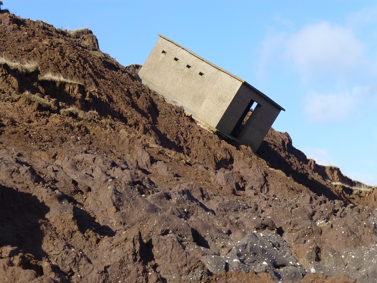
Descent to the beach was steady at first...
(TA 26341 38627) [AL60] – 3
...despite a steep angle [16 February 2014].
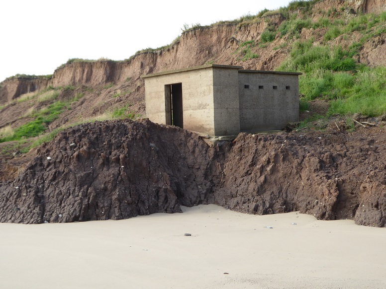
(TA 26341 38627) [AL60] – 4
Movement was brought to a temporary halt partly as a result of cliff material being pushed and accumulating before the unit [3 August 2016].
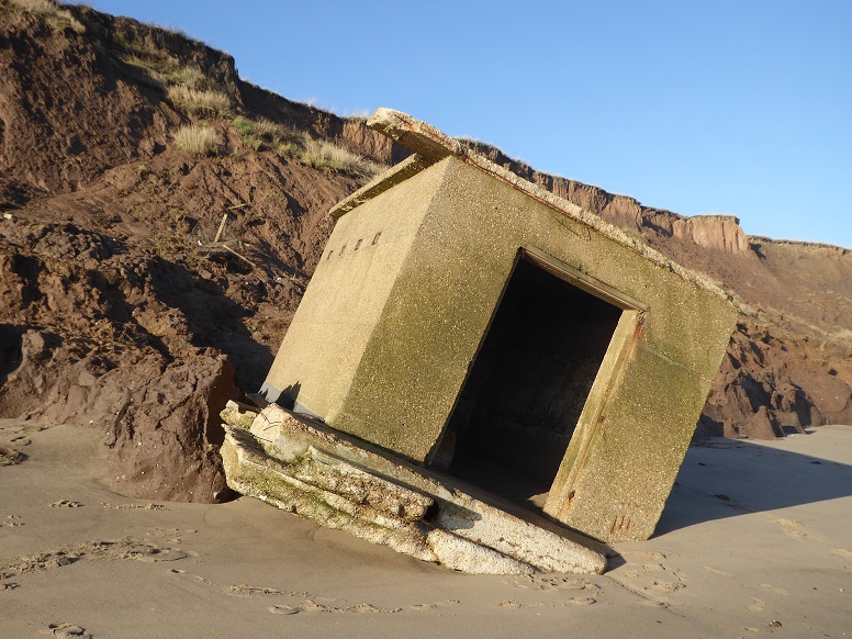
(TA 26341 38627) [AL60] – 5
In all, the journey from land to sand took nearly seven years. Since arrival at the beach the frontal section has been lost [14 February 2019].
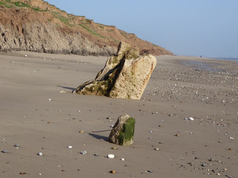
(TA 26341 38627) [AL60] – 6
Having a relatively large entrance and little interior escape for wave energy, the CHL generator unit was not expected to survive long in the beach environment. Present during the summer of 2021, by the following spring there was little left to see [14 May 2022].
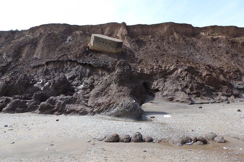
TA 26427 38565 [AL39] – 1
Pillbox begins a slide down the cliff [5 May 2012].
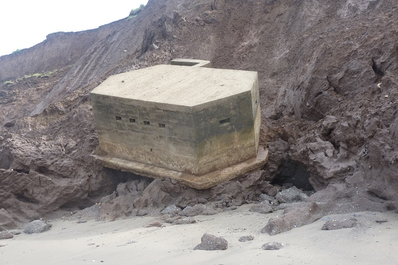
TA 26427 38565 [AL39] – 2
Almost on the beach. The slide path indicates a deflection (towards the camera) round a snout at the foot of the cliff [10 June 2012].
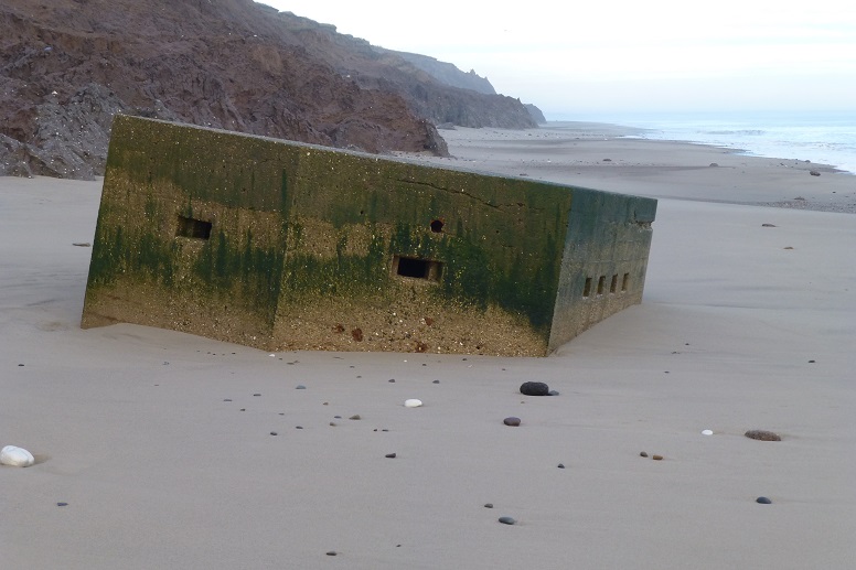
TA 26427 38565 [AL39] – 3
Taken days before the tidal surge of December 2013, the picture shows a full, sandy beach [27 November 2013].
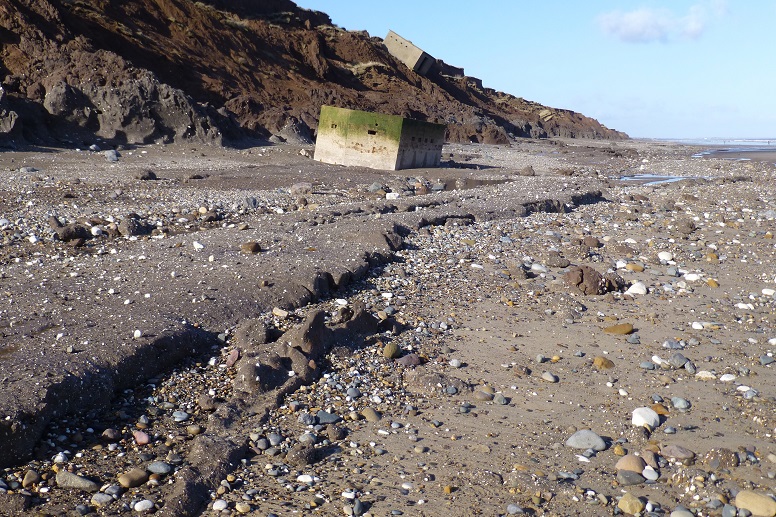
TA 26427 38565 [AL39] – 4
A few winter weeks later and the upper beach is completely removed to expose the clay platform. In the background, the neighbouring CHL unit can be seen part way on its slide down the cliff [16 February 2014].
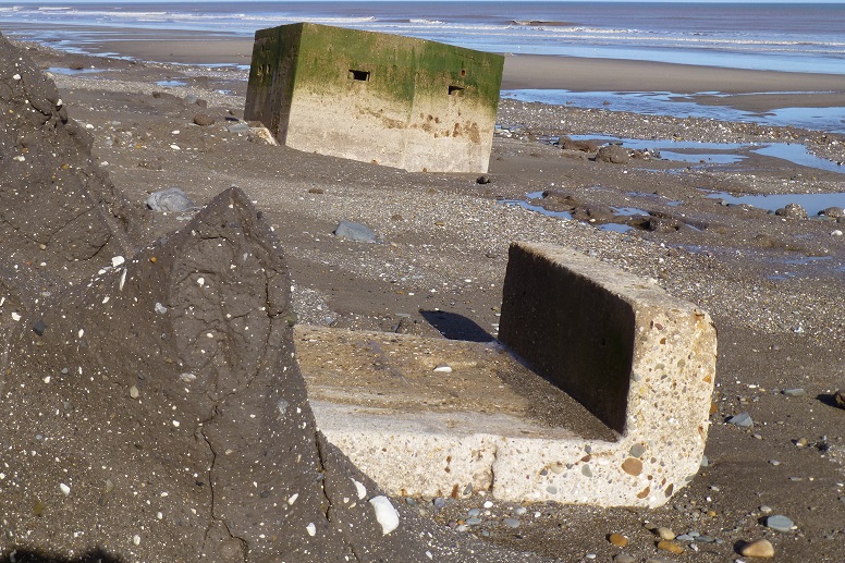
TA 26427 38565 [AL39] – 5
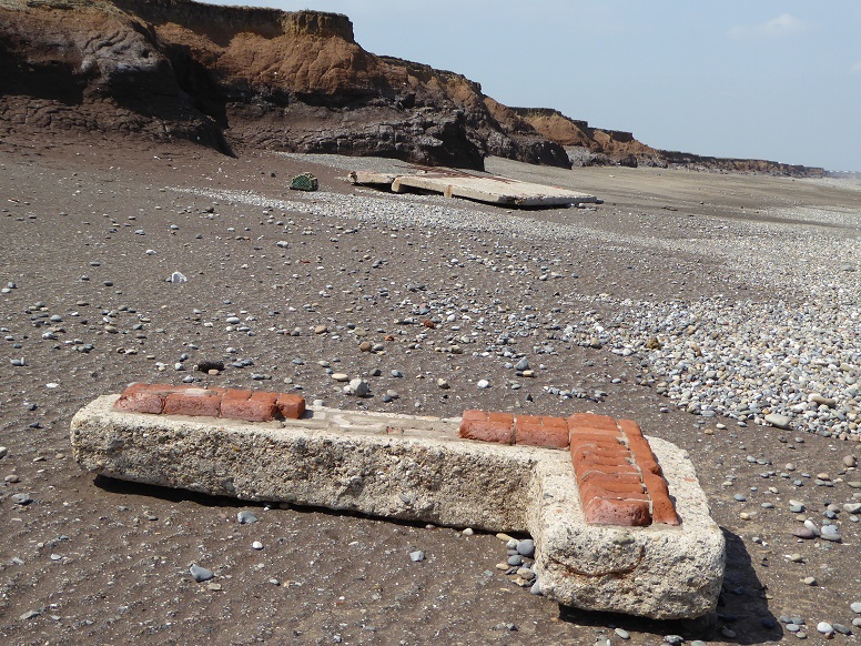
The most vulnerable part of a pillbox of the lozenge type is the L-shaped (anti-)blast wall designed to protect the entrance during enemy attack. If the wall is not broken off on the way down the cliff then it is unlikely to remain attached for long under pounding by the waves [16 February 2014].
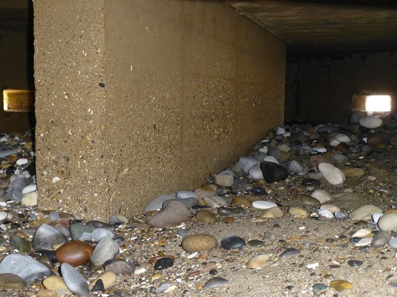
TA 26427 38565 [AL39] – 6
Every pillbox picture gallery begs an interior shot. The central wall of the unit not only supports the roof but helps protect occupants from ricochet. Beach sediment fills the inside almost to the embrasures (openings from which to fire a weapon) [16 February 2014].
Video of storm waves breaking over the pillbox [6 December 2013]:
Windows Media Player (.wmv)
QuickTime (.mov)
tablet (.mp4)
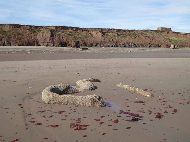
TA 26557 38600 [AL63]
Identified as the remains of a beach searchlight housing, the piece is 159 metres from the foot of the cliff. In the background are units AL39 and, to the right below stacked bales of hay, AL60 [19 August 2019].
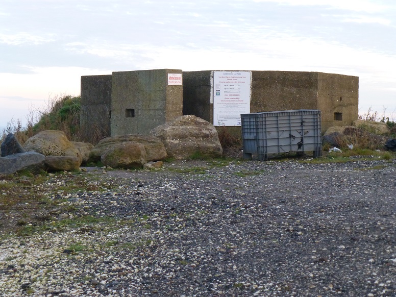
TA 26636 38061 [AL44]
Guardian of the car park at East Newton [27 November 2013].
The car park is now closed and inaccessible to vehicles.
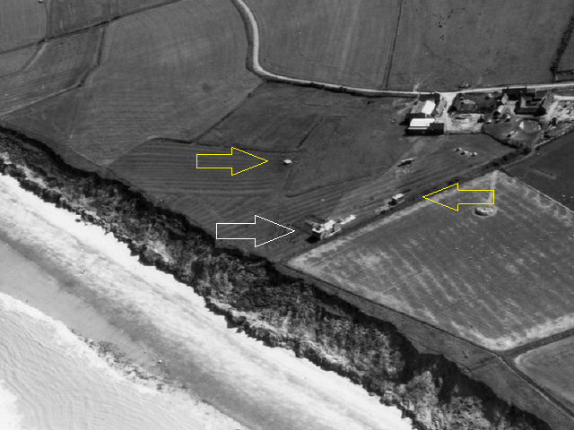
Cambridge University Collection of Aerial Photography ART48 © copyright reserved (arrows added).
TA 26405 38645 [AL37]
A single storey observation post (white arrow), having a slightly raised section facing the sea, accompanied pillbox AL39 and the CHL unit AL60 (yellow arrows) at East Newton until being lost to erosion around 1992 [13 June 1967].
Ringbrough
TA 27329 37265 [part of AL52]
tower (battery observation post) on beach
See Ringbrough page.
Ringbrough Farm (site of)
TA 27245 37189 [AL55] by side of entrance
Ringbrough, south of
TA 27821 36542 [possibly part of EG1] on beach
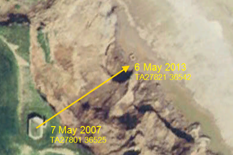
TA 27821 36542 – 1
In its descent, the Beacon Hill pillbox south of Ringbrough moved to seaward by some 30 metres as it followed the slope of the receding cliff face (such repositioning is sometimes known as ‘monument migration’) [Google Earth historical: 2007].
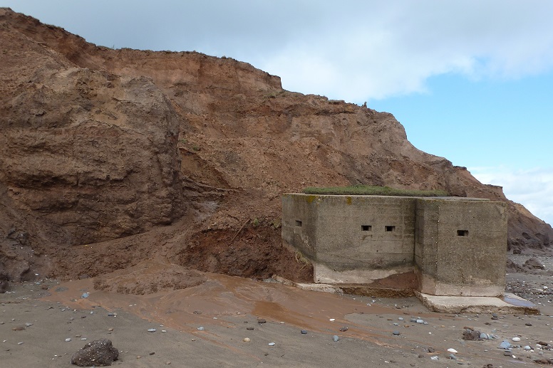
TA 27821 36542 – 2
The structure is recently deposited at the foot of the cliff, capped by a thin mat of vegetation, blast wall attached. A mudflow oozes round it on to a low beach [5 May 2012].
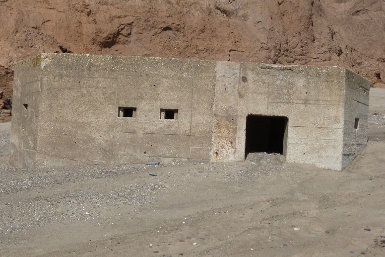
TA 27821 36542 – 3
A year and a day later. The blast wall is now detached and lies under high sand [6 May 2013].
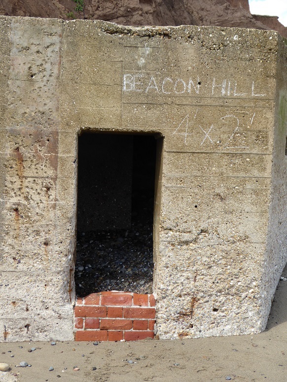
TA 27821 36542 – 4
Dimensions of entrance (4ftx2ft). Beacon Hill refers to the former cliff top location of the pillbox (see Paul Glazzard) [14 July 2014].
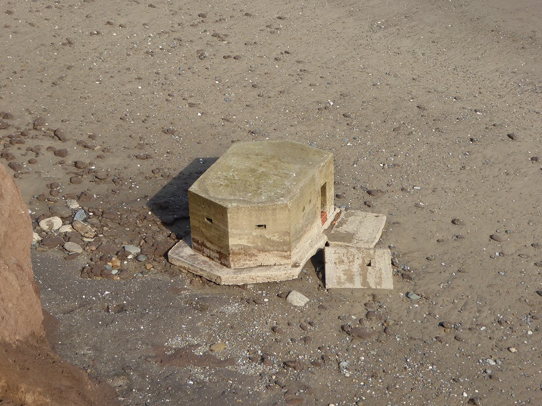
TA 27821 36542 – 5
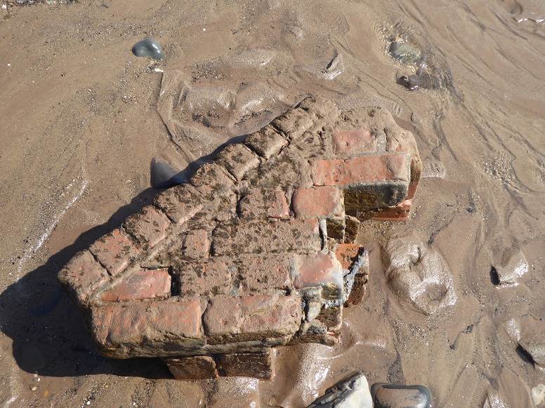
Another low beach reveals the fallen blast wall. The platform which once supported the wall is now separated from the rest of the base and has dropped slightly [22 September 2014].
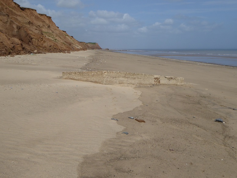
TA 27821 36542 – 6
Summer of 2021, Ringbrough south pillbox disappeared from view, it being completely covered by a sand salient. Here, it is seen re-emerging [14 May 2022].
Grimston
TA 28753 34940 [EG27] in copse
Hilston
TA 29063 34347 [RO6] in field
TA 29827 33777 [RO11] on beach
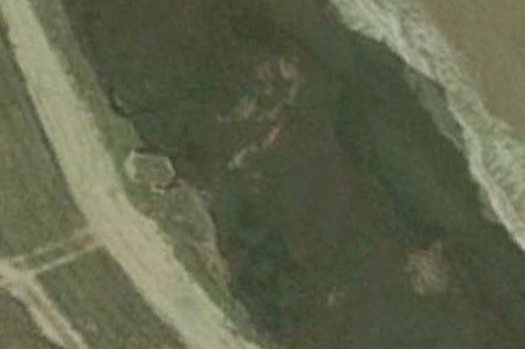
TA 29827 33777 [RO11] – 1
The southermost Hilston pillbox at the edge of the cliff, by the side of Pastures Lane [Google Earth historical: 2003].
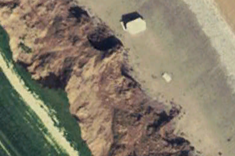
TA 29827 33777 [RO11] – 2
Linear displacement after arrival on the beach is about 27 metres.
A slight change of orientation is noticed. The blast wall has become detached and lies some 17 metres distant.
The ‘tail’ in the image is in fact a corner of the concrete base partly in shadow [Google Earth historical: 7 May 2007].
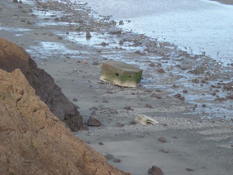
TA 29827 33777 [RO11] – 3
The structure sits on a thin beach after further positional disturbance, caused by wave action.
As with some other pillboxes, the entrance was sealed possibly on decommissioning, though the blockwork here is disintegrating [17 September 2011].
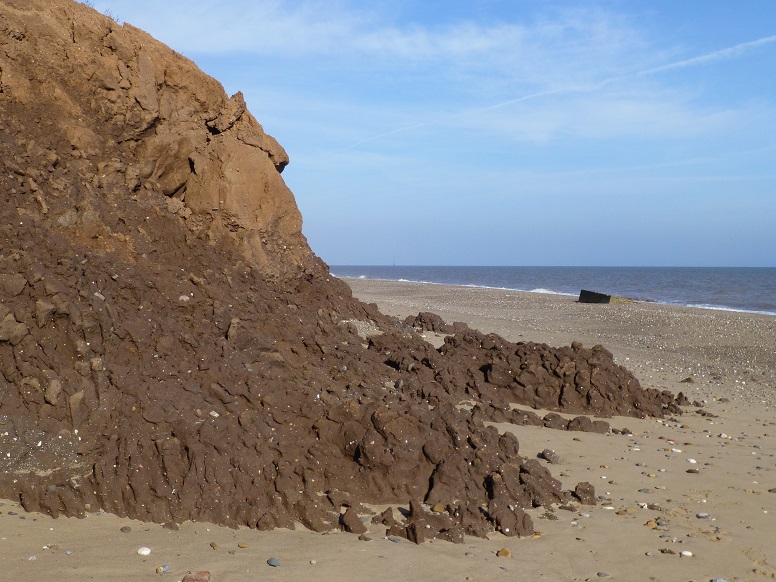
TA 29827 33777 [RO11] – 4
In this picture, the pillbox is largely buried by a high beach [28 September 2013].
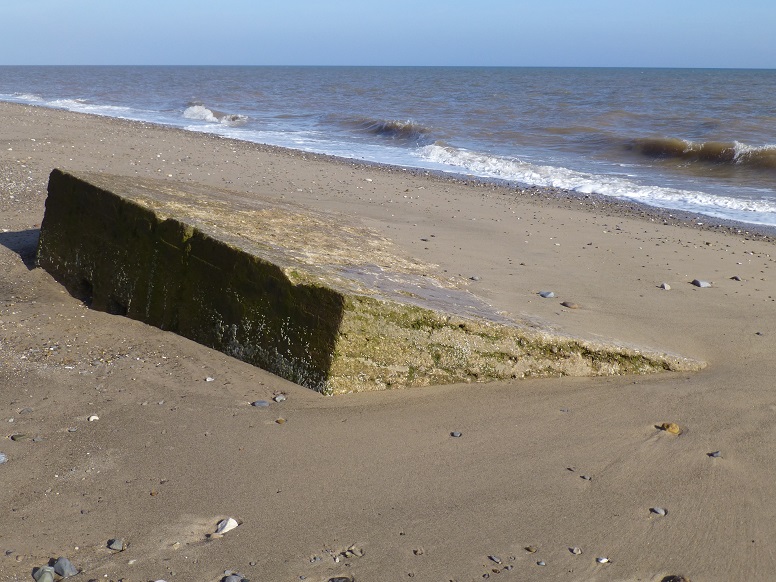
TA 29827 33777 [RO11] – 5
Close up.
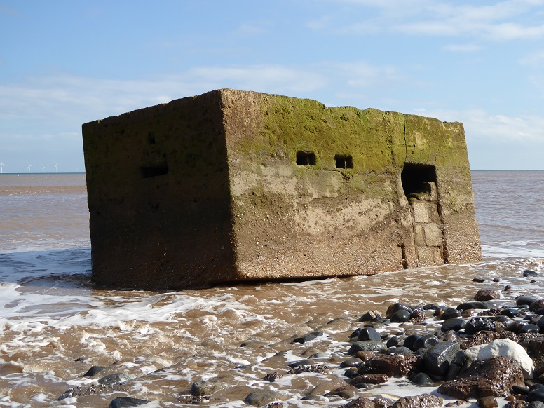
TA 29827 33777 [RO11] – 6
Intact but exposed by another thin beach [22 September 2016].
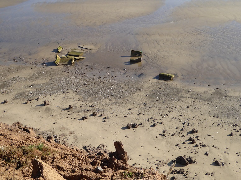
TA 29827 33777 [RO11] – 7
One year on, and Hilston beach pillbox is no more, the collapsed sections reduced to dispersing fragments [2 September 2017].
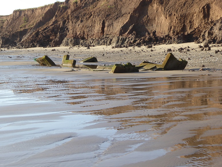
TA 29827 33777 [RO11] – 8
From the beach [2 September 2017].
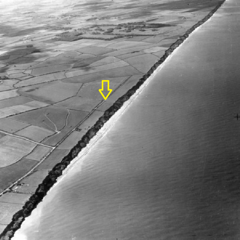
Cambridge University Collection of Aerial Photography © copyright reserved (arrow added).
TA 29827 33777 [RO11] – 9
An oblique aerial photograph, taken ten years after installation, offers an idea of the earlier setting of the pillbox, and of coastal loss. RO11 is situated approximately 73 metres inland from the cliff edge [17 June 1951].
The cliff-parallel section of Pastures Lane is now completely gone.
Tunstall
TA 30162 32894 [RO33] boundary between fields
TA 31192 31960 [RO46] remains on beach
TA 31192 31960 [RO55] bunker inverted on beach
TA 30817 31657 [RO63] hedgerow between fields
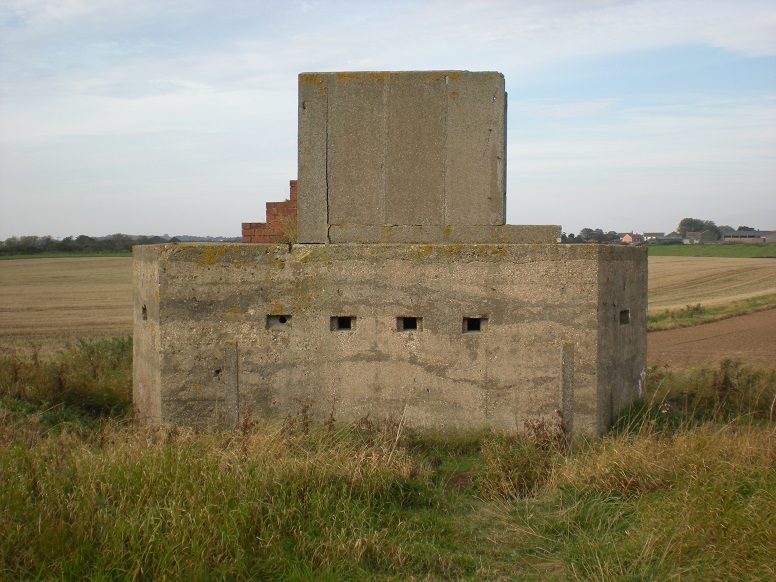
TA 31192 31960 [RO46] – 1
On top of a (locally) standard lozenge pillbox sits an additional structure dating from the Cold War. This is an Orlit post, named after the manufacturer and erected by the Royal Observer Corps (ROC). There is also an associated underground bunker [24 September 2011].
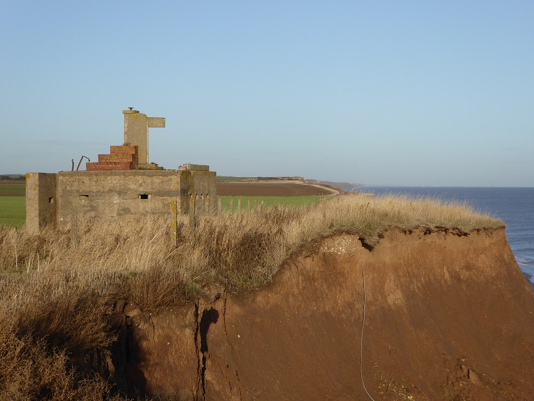
TA 31192 31960 [RO46] – 2
Most of the superstructure has collapsed. The edge of the cliff measures 7.2 metres from the pillbox [12 November 2018].
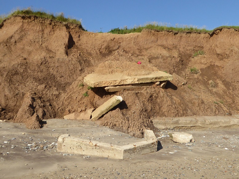
TA 31192 31960 [RO46] – 3
In late 2023, the unit toppled over the cliff and was soon in pieces [19 July 2024].
Drone footage compilation by Paul Mouncer.
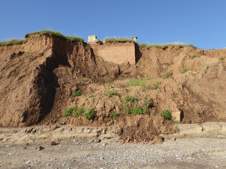
TA 31192 31960 [RO55] – 4
The underground bunker seen emerging from the upper cliff [19 July 2024].
Between the mornings of 22 and 23 January 2026 the bunker toppled to be almost on the beach. A final stage of emergence from the cliff was recorded essentially as daily drone footage by Davey Robinson assisted by Tracy Chapman, and shared as ‘Bunker Watch’. The occasion received wide media attention, attracting interest nationally and from abroad.
A note on the Tunstall pillbox and bunker
Interior of the underground bunker by Mark Russell, 2009:
[1]
[2]
(from Subterranea Britannica).
Sand le Mere
TA 31682 31305 [RO77] end of Seaside Lane
TA 31668 31012 [RO96] boundary between fields
TA 32121 30904 [RM9] beach searchlight, on beach
TA 31995 30717 [RM12] boundary between fields
TA 32121 30904 [RM9] – 1
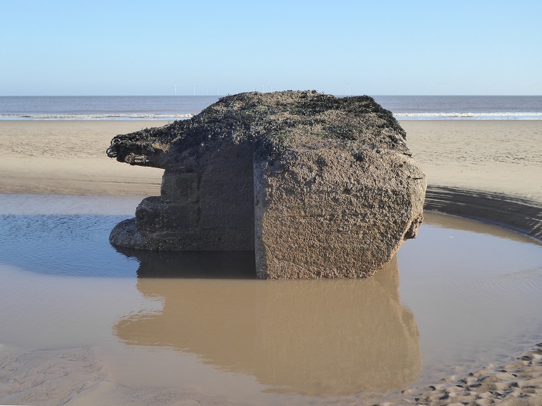
Military defence preparations at the low-lying site of a mere were extensive – see Austin J Ruddy. Much has been lost to coastal erosion, either directly or through recycling of concrete pieces to protect the cliffs.
A beach light emplacement survives, pictured at low tide surrounded by deep scour, some 106 metres from the cliff foot [26 February 2021].
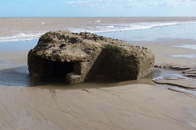
TA 32121 30904 [RM9] – 2
The same piece on a previous occasion, less available though more accessible [29 September 2012].
Waxholme
TA 33037 29355 [RM39] corner of field
Hollym
TA 35706 26051 [HL10] on beach
.png)
TA 35706 26051 [HL10] – 1
Hollym pillbox lying 14 metres inland from the cliff line [Google Earth historical: 2003]. Within five years it was at the cliff edge (see Paul Glazzard). Seaward displacement on descent to the beach is approximately 23 metres.
.jpg)
TA 35706 26051 [HL10] – 2
Distance from the foot of the cliff is stepped out at 140 feet (about 42.5 metres) [3 September 2012].
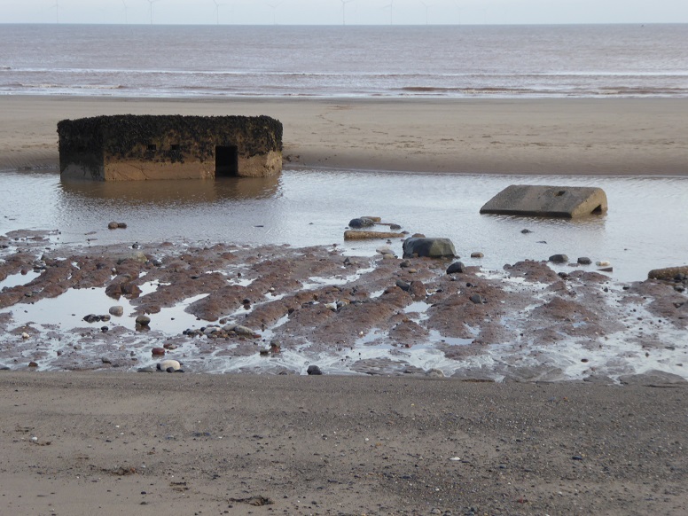
TA 35706 26051 [HL10] – 3
Pillbox with detached blast wall [16 November 2017].
Holmpton, The Runnell
TA 36678 24686 [HM3] on beach at mouth of dyke
.jpg)
TA 36678 24686 [HM3] – 1
The Runnell (Nevills Drain), Holmpton [20 April 2013].
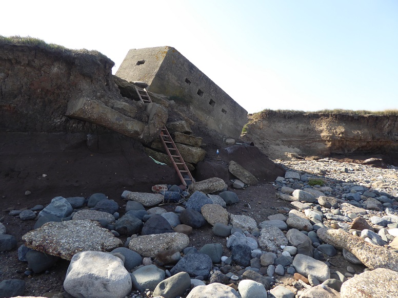
TA 36678 24686 [HM3] – 2
The pillbox partially slipped into the dyke whilst still inland around 1992 [21 September 2020].
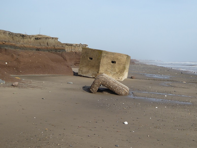
TA 36678 24686 [HM3] – 3
On the beach. A blast wall, detached presumably at the time of the slip and long absent from view, makes a reappearance [2 May 2024].
Holmpton, Seaside Road
TA 36822 24765 [HM1] group of anti-tank blocks, on beach
TA 36986 24570 beach searchlight, on beach
TA 36834 24536 [HM5] gunnery markers shelter (fragmented)
(TA 36961 24314 [HM10] cliff edge
(TA 36954 24311 [HM11] underground
TA 37190 23990 [HM21] side of road, within dense growth (unconfirmed)
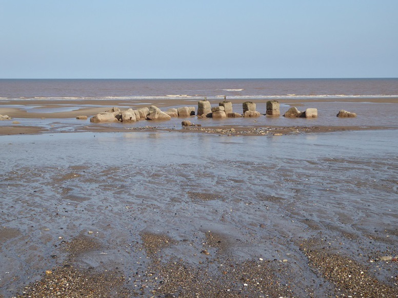
TA 36822 24765 [HM1]
Anti-tank blocks originally positioned across the mouth of The Runnell are currently some 165 metres from the cliff [21 September 2020].
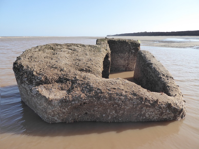
TA 36986 24570 [possibly HM4]
Remains of a beach searchlight. The piece lies 255 metres south-east of the HM1 anti-tank blocks, and at a similar distance to them from the cliff [21 September 2020].
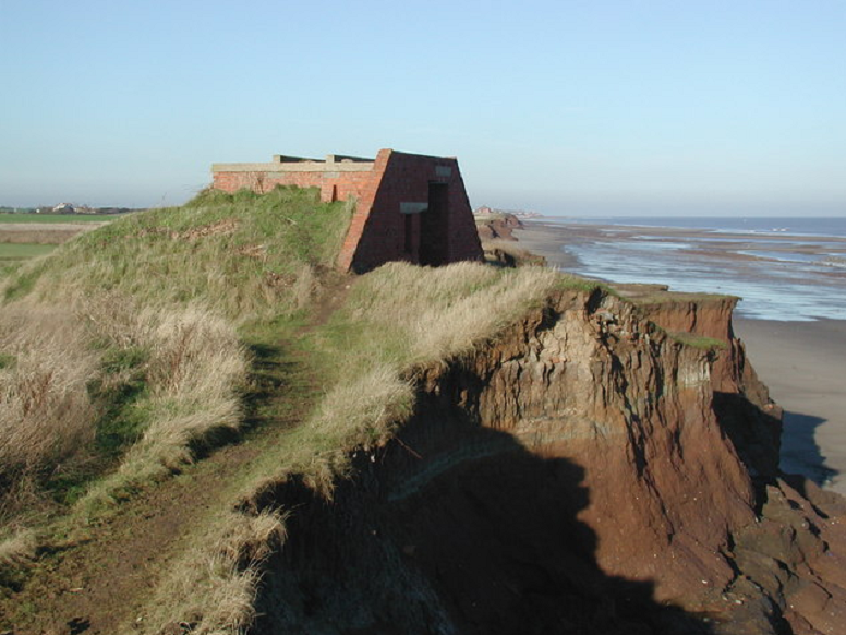
TA 36834 24536 [HM5] – 1
This unusual building was constructed – originally several metres from the cliff – to protect markers who were tasked to count hits on targets at the wartime Holmpton air-to-ground gunnery range [picture by Paul Glazzard: 19 November, 2006, with thanks to Peter Kirk of Kent for information].
TA 36834 24536 [HM5] – 2
Coastal erosion catches up. A corner piece and what appears to be the roof, inverted, on a beach mostly stripped of cover [10 May 2017].
TA 36834 24536 [HM5] – 3
Other remnants may be found downdrift of the site [20 April 2019].
TA 36961 24314 [HM10] - 1
Mounted on a concrete raft partly over a ditch, the main body has undergone subsidence, bringing it away from the entrance blast wall.
As at Tunstall (RO46/RO55), pillbox HM10 was modified as a Royal Observer Corps (ROC) Orlit post. Brackets on the upper wall to the right of the entrance once held a ladder to the roof, where stubs of railings protrude. Halfway between the embrasure and the base is a small square viewing slot [20 April 2013].
TA 36961 24314 [HM10] - 2
Google Earth historical places the pillbox at 44.5 metres from the edge of the cliff in 2003. For this picture, the distance is down to 10.1 metres [20 April 2019].

TA 36961 24314 [HM10] - 3
Two metres per year of cliff loss continues, and distance from the edge is turning negative [2 May 2024].
In late autumn 2024, pillbox HM10 fell to the beach breaking into several pieces.
TA 36954 24311 [HM11]
Surface evidence of an ROC underground bunker, landward of the pillbox [20 April 2013].
A note on the Holmpton pillbox and bunker
Holmpton, Old Hive
TA 38077 23029 fragment near mouth of dyke
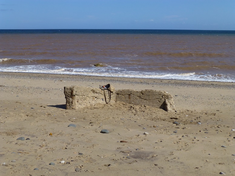
TA 38077 23029 – 1
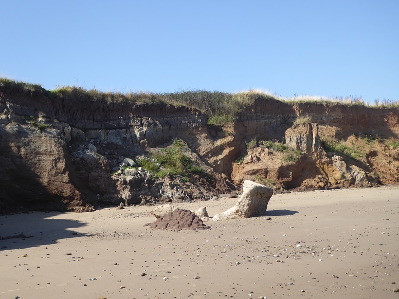
Even smaller pieces can be useful as reference for observing beach changes.
Against a nearshore sea turned brown by eroded clay held in suspension, the fragment serves as a rest point [31 August 2013].
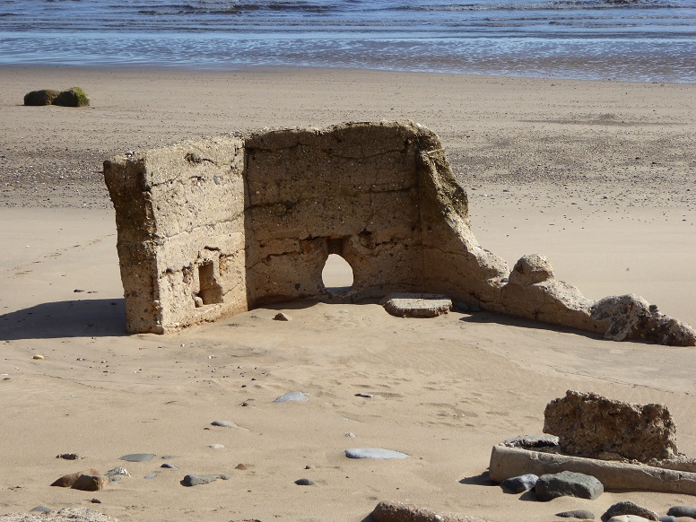
TA 38077 23029 – 2
Beach level in this picture is lowered by a metre [30 May 2015].
During 2016 and 2017 the piece was completely covered by sand and not visible.
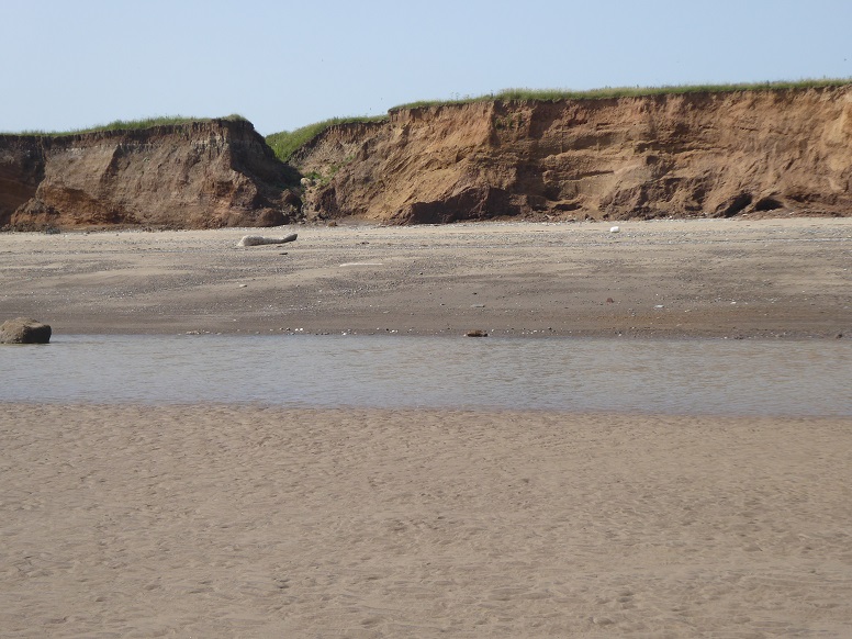
TA 38077 23029 – 3
The fragment viewed from the approximate position of the cliff line when the original structure was built. It may have been installed by the side of the Old Hive dyke, seen behind [29 June 2019].
TA 38080 22982 – 4
It is not known when the unit descended to the beach but, once there, the remnant seems to have remained in the same position (coordinates as heading) for a number of years even as the cliff receded. From the situation in the previous picture, it has shifted almost due south and nearer the cliff by a distance of 47 metres. In the background, aligned with the piece, the mouth of Old Hive has been severely eroded [4 September 2023].
Dimlington High Land
TA 38968 21879 (centre) [EA30] on beach
Dimlington High Land was chosen in the early years of the Second World War as a location for Chain Home Extra Low (CHEL) radar detection equipment.
The station included various huts and a steel lattice tower carrying a scanner. Nothing survives of the installation except for four large concrete blocks on which the tower was mounted.
Google Earth historical shows three of the blocks on the beach at the foot of the cliff by 2003. For convenience of reference, they became The Three Sisters.
The fourth block remained in situ for another ten years or so before descending the cliff.
As with other examples, the mounts assist in observing coastal changes.
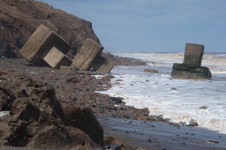
TA 38968 21879 [EA30] – 1
A low beach exposes the blocks almost entirely. Accompanying mudballs are a sign of active cliff erosion [12 May 2012].
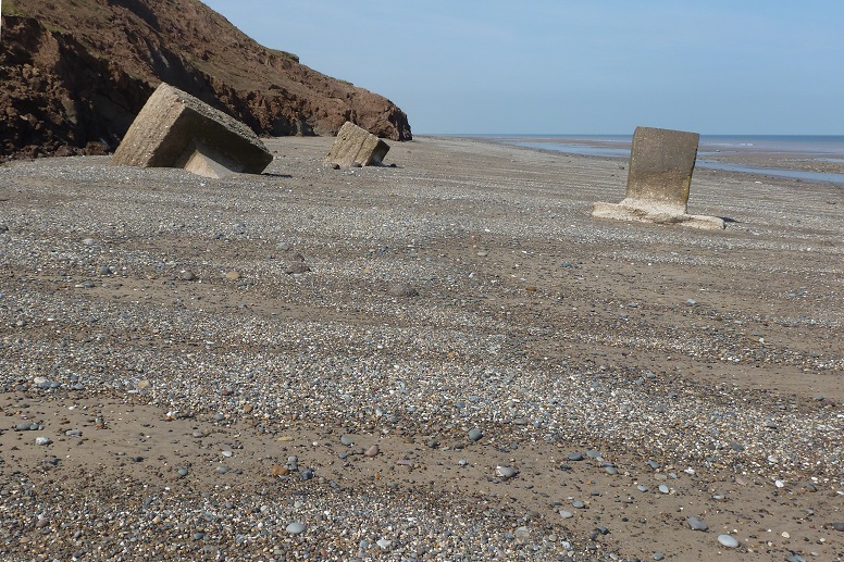
TA 38968 21879 [EA30] – 2
Here, the beach has a moderate cover overlain by cross-shore shingle [3 September 2012].
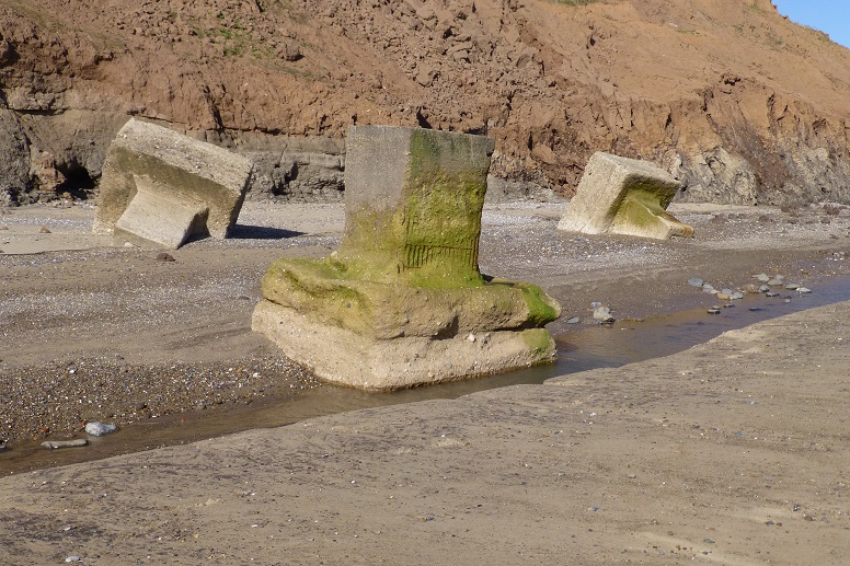
TA 38968 21879 [EA30] – 3
A runnel passes round the base of the nearest block while a sand ridge occupies the foreground. These identify a beach feature known as an ord system. Upper beach shingle is cliff-parallel [31 August 2013].
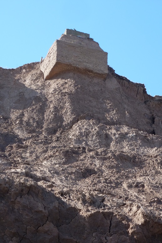
TA 38968 21879 [EA30] – 4
Maintaining position [3 April 2013].
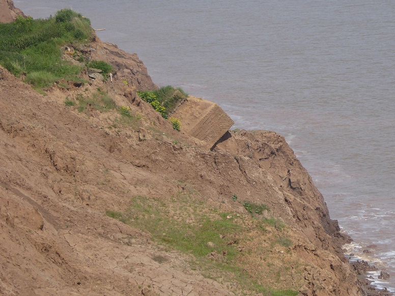
TA 38968 21879 [EA30] – 5
Descent, though, is inevitable [1 June 2017].
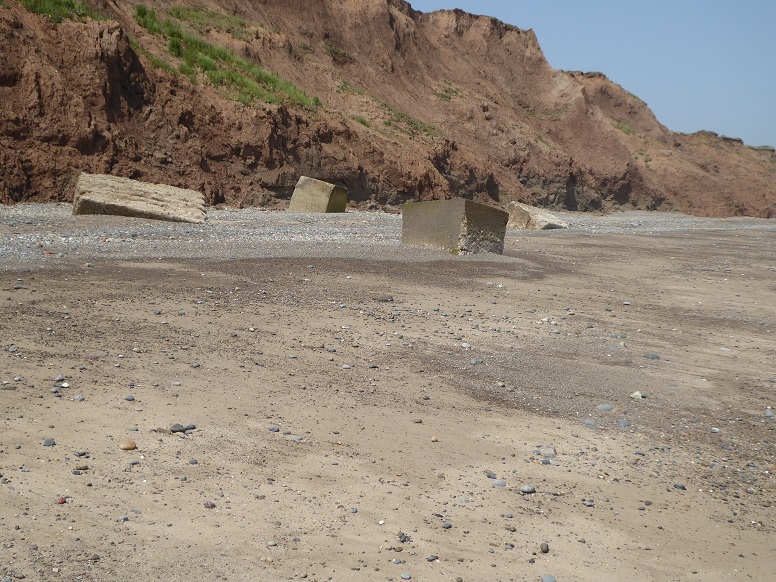
TA 38968 21879 [EA30] – 6
The fourth (centre, nearest cliff) belatedly joins the other three. A high beach level conceals the full shape of the mounts [29 June 2019].
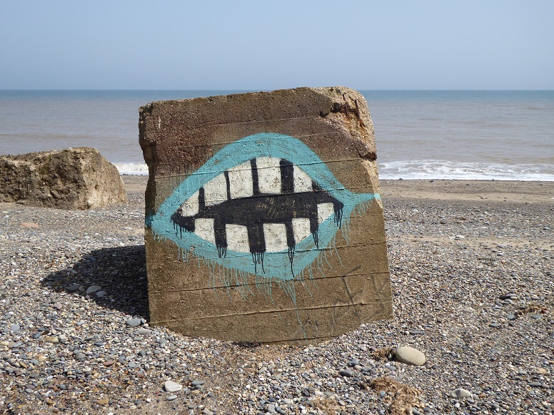
TA 38968 21879 [EA30] – 7
This sister has teeth! [29 June 2019].
Easington south
TA 40791 18921 [EA90] on beach
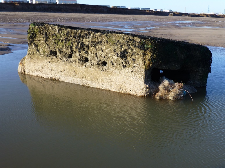
TA 40791 18921 [EA90] – 1
Showing signs of wear but still intact, the Easington south pillbox is seen here located about 87 metres from the cliff. Marine growth may initially make the image look slightly out of focus. In the background at the far right of the picture is part of the Easington gas terminal [2 January 2014].
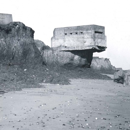
Reproduced from John Dossor (1955), ‘The Coast of Holderness: The problem of erosion’, Plate 9, Figure 2, Proceedings of the Yorkshire Geological Society, Vol 30, 133-145. By permission of the Council of the Yorkshire Geological Society.
TA 40791 18921 [EA90] – 2
Picture taken by Cecil Wright Mason (1884-1964), the same pillbox precariously overhangs the cliff at ‘Lane End’ (Seaside Road). Although clearly a lozenge type, modifications are apparent [11 March 1950].
Easington, south of
TA 40860 18535 [EA100] on beach
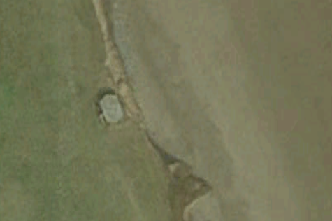
TA 40860 18535 [EA100] – 1
Pillbox perched broadside to the edge of the cliff [Google Earth: 2003]. See Ian Sanders.
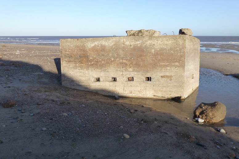
TA 40860 18535 [EA100] – 2
Toppling rather than sliding, the structure arrived on the beach in an inverted position [2 January 2014].
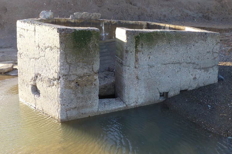
TA 40860 18535 [EA100] – 3
The base has collapsed into the shell [2 January 2014].
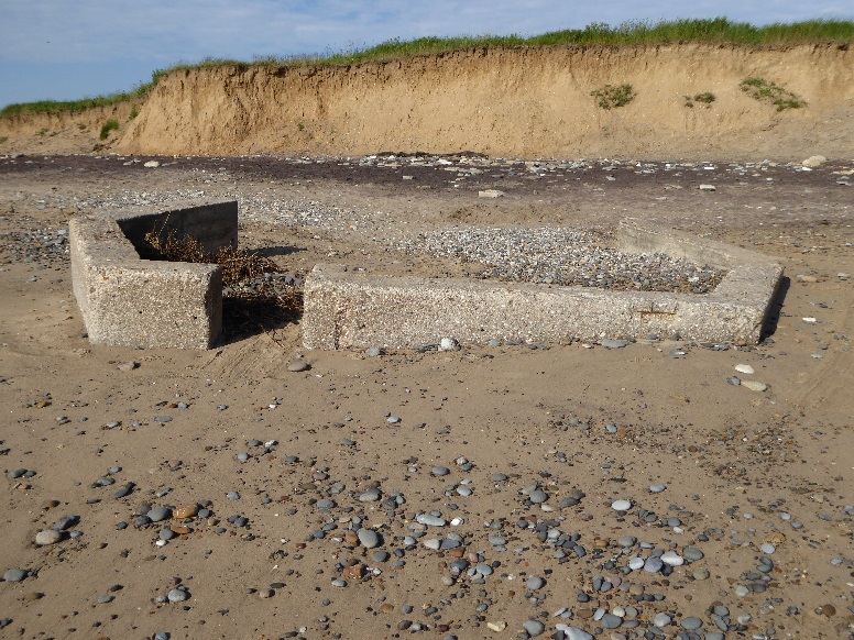
TA 40860 18535 [EA100] – 4
Over seven years on, the back section has broken away. Remains are almost buried by a high beach level [16 June 2021].
Easington lagoons
TA 40979 17723 [EA126] by side of lagoon
TA 40986 17440 [EA141] on bank
Kilnsea, north of
TA 40452 16808 [EA160] by side of dyke
Kilnsea
TA 41064 16643 [EA164] accoustic mirror, concrete
TA 40953 15792 [EA198] on bank of estuary at bend in road
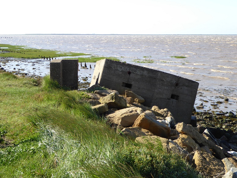
TA 40953 15792 [EA198]
Only the blast wall retains original position as the pillbox at Kilnsea slips to the shore of the Humber estuary. Curving away in the distance is the Spurn peninsula [11 August 2014].
Godwin Battery, Kilnsea
TA 41374 16206 [EA175] west of battery, in copse
TA 41745 16080 various structures, mostly on beach
See Godwin Battery, Kilnsea page.
Spurn Nature Reserve
TA 41676 15373 [EA211] estuary side of road
(Installations at the tip of Spurn not included.)
Page prepared by Brian Williams in August 2013. Updates as per captions.